Statewide Analysis
At the statewide scale, we are looking for patterns of habitat distribution that dominate large landscapes. This can be thought of as a view of the land from 50,000 feet above the Earth’s surface. This view is interpreted through the behaviors and natural histories of some of Washington’s more mobile vertebrate wildlife, using computer models and our best understanding of what influences these species in their movement choices and the ways in which landscape features contribute to their survival and well-being. At this scale, we have analyzed the landscape with two approaches: a functional focal species approach and a structural landscape integrity approach.
The statewide analysis is a first-step toward identifying regionally important areas using relatively coarse-scale data. The analysis also helps to prioritize areas that need additional attention to address important habitat connectivity concerns at a more localized ecoregional scale, using finer-resolution data and field assessment approaches.
This statewide work was done with support from 444S Foundation, Great Northern Landscape Conservation Cooperative, Northwest Wildlife Conservation Initiative (supported by the Doris Duke Foundation), TransWild Alliance, United States Fish and Wildlife Service (State Wildlife Grants), Wilburforce Foundation, and Wildlife Conservation Society’s Wildlife Action Opportunities Fund.
Complementary Products
All files in .pdf format.
Washington Habitat Connectivity Analysis Fact Sheet
Washington Habitat Connectivity Analysis: What it is and What it is Not
Washington Connected Landscapes Project: Statewide Analysis
Questions and requests for hard copies of the Executive Summary can be submitted via our Contact Us page. All files in .pdf format.
Washington Statewide Habitat Connectivity Analysis. Full document is a large download, see below for individual chapter files.
- Chapter 1 – Introduction WHCWG Statewide Analysis
- Chapter 2 – Methods WHCWG Statewide Analysis
- Chapter 3 – Results and Discussion
- Chapter 4 – Using the Statewide Connectivity Analysis
- Chapter 5 – Lessons Learned from the Analysis Process
- Chapter 6 – Conclusions and Future Work
Appendices (all files in .pdf format)
- Appendix A
- Appendix B
- Appendix C
- Appendix D
- Appendix E
- (Or get all maps in one .zip download)
- Area and Linkage Statistics (.xls)
Data Layers
Data layers are currently available on Databasin, an interactive online mapping tool, in the Washington Connected Landscapes Project gallery. You must have a Databasin free account to view these files.
Four main GIS datasets will be available to the public as a result of our statewide analysis: Base Layers, Landscape Integrity, Guilds, and Focal Species. If you have any questions in regards to data layers please visit our contact us page.
List of all data layers currently available. This excel spreadsheet lists all data layers available for download below.
All data layers are packaged into zip files for download.
- Base Layers
- Landscape Integrity (coming soon)
- Focal Species Guilds
- Focal Species (Individual zip files for relevant files and each focal species)
- Focal species HCAs, least-cost path lines, sticks
- Focal species resistance factors ESRI gdb format
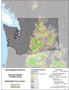
- American Badger
- American black bear
- American Marten
- Bighorn Sheep
- Black-Tailed Jackrabbit
- Canada Lynx
- Elk
- Greater Sage-Grouse
- Mountain Goat
- Mule Deer
- Northern Flying Squirrel
- Sharp-Tailed Grouse
- Western Gray Squirrel
- Western Toad
- White-Tailed Jackrabbit
- Wolverine

