
Okanagan-Kettle subregion
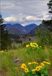
Sinlahekin Valley, Washington. Credit: Justin Haug
The Okanagan-Kettle subregion is one of three subregions that we identified along the transboundary landscape shared by Washington and British Columbia. Located between the Cascade Range and the Rocky Mountains, the Okanagan-Kettle subregion has been identified by previous connectivity analyses and management plans as a priority for maintaining a connected network of habitats both north–south between British Columbia and Washington, and east–west between large blocks of relatively secure mountainous habitats. In Washington, this subregion includes portions of the Okanogan-Wenatchee and Colville National Forests as well as state, private, and Colville Confederated Tribal lands. In British Columbia much of the subregion is Crown Land including protected areas such as Cathedral Park, Snowy and South Okanagan Grasslands Protected Areas in the southwest, Granby and Gladstone Parks in the southeast, and Okanagan Mountain Park in the centre of the region but a significant portion of the subregion that is important for maintaining and restoring connectivity is in private ownership. The subregion lies within the territory of member bands within the Okanagan Nation Alliance.
This landscape has a long history of facilitating the movement of people and wildlife. Although natural barriers to movement such as mountains, rivers, and lakes have always existed on this landscape, more recent development associated with human activity have further restricted movement options for wildlife. A major geographic feature in the subregion is the long and narrow Okanagan (Okanogan) Valley, which lies in the rain shadow between the Cascade Range and the Columbia Mountains. Formed by glacial activity, it is characterized by low hills, and long slender lakes, especially in BC. The geography of the Okanagan Valley has resulted in a concentration of development along the valley bottom that has impacted grassland habitats and associated species. In BC, more than one-third of the grasslands have been lost to development and what remains is considered endangered. Human activity has also impacted east–west movement for montane species that must cross the valley to access higher elevation habitats. Forest management, recreational and urban development, transportation corridors, population growth, and viticulture land use are accelerating in this area of the subregion. Additional stressors associated with the overarching impact of future climate change highlight the need for information to help guide connectivity conservation efforts and management. Therefore, our Transboundary Subgroup prioritized this subregion for collaboration and analysis to clearly identify the key connectivity patterns on this landscape and provide case studies of local partners translating the science to an operational scale for land management and conservation. This work is summarized in our report below.
- Appendix A – Modeling background (PDF, 146KB)
- Appendix B – Washington-British Columbia Transboundary Climate-Connectivity Project: Key Climate Impacts and Adaptation Actions for the Okanagan-Kettle Region (this link takes you to the full project’s Databasin gallery where the Okanagan-Kettle Case Study has its own folder with data and a report)
- Appendix C – Application of Connectivity Planning Work: Summary of a Multi-party Stakeholder Workshop (PDF, 452KB)
- Appendix D – Spotted Lake (Ha? Ki lil xw) Landscape Connectivity Workshop (PDF, 654KB)
- Appendix E – Decision Support System for Landscape Connectivity Planning (PDF, 1.5MB)
- Appendix F – Metadata (currently being packaged and will be available in June 2016)
Data layers from this analysis will also be made available in our Washington Connected Landscapes gallery on Databasin by June 2016.