
Statewide analysis map gallery
This page is a gallery of the maps generated from our Washington Connected Landscapes Project: Statewide Analysis. Data layers that created these maps are available on our statewide analysis page, and for viewing within our Databasin gallery. Click on any thumbnail image of a map below to view a larger version.
Base Layer Maps
Statewide analysis area – Washington and portions of neighboring states and provinces.
Species Guilds and Landscape Integrity Results
The statewide analysis applied both landscape integrity and focal species modelling approaches. 16 focal species were analyzed, and were able to be grouped into three different connectivity guilds: (1) generalist (including species such as mule
deer and western toads; (2) montane (including species such as American black bears and wolverines; and (3) shrubsteppe (including species such as American badgers and white-tailed jackrabbits. Maps below show the combined statewide display of connectivity networks for an individual guild and landscape integrity results combined:
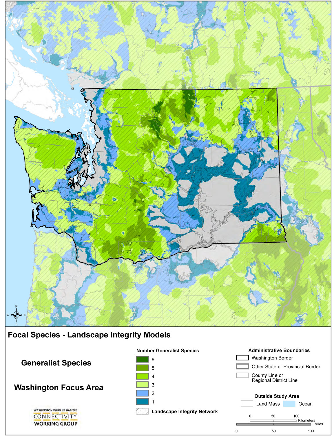
Generalist guild and landscape integrity
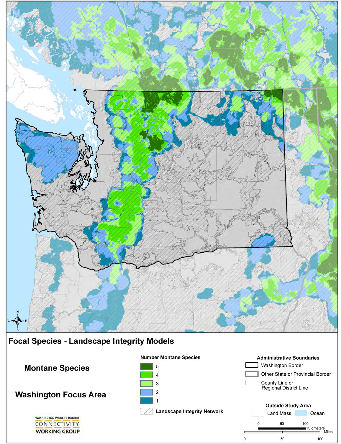
Montane guild and landscape integrity

Shrubsteppe guild and landscape integrity
Focal Species Results
Each focal species analysis produced several map products that are informative in understanding the network of habitats and connections between them for an individual species. These products include maps for resistance layers, habitat concentration areas, cost-weighted distance, and linkage zones (see example from the elk analysis to the right). Each product provides an informative through this species needs on the landscape, and together these products provide a view of a connected network of habitats for an individual species in our analysis area. Below a link is provided to a map for each of these products for the 16 focal species analyzed in the statewide analysis. An asterik indicates if this species was analyzed at a finer scale by our working group through our Columbia Plateau analyses.
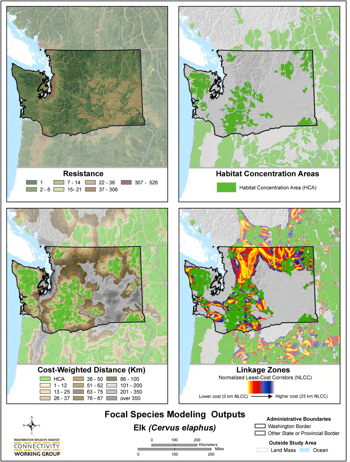
Model outputs from statewide analysis for elk. 2010
- American badger
- American marten
- Bighorn sheep
- Black bear
- Blacktailed jackrabbit
- Canada lynx
- Elk
- Greater sage grouse
- Mountain goat
- Mule deer
- Northern flying squirrel
- Sharp-tailed grouse
- Western grey squirrel
- Western Toad
- Whitetailed jackrabbit
- Wolverine
Landscape Integrity Resultsy
Landscape Integrity – base analysis of human footprint across coverage area
Landscape Integrity Core Areas
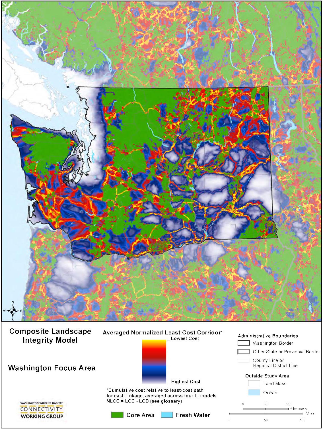
Composite Landscape Integrity Model – linkages
To see additional maps visit our Climate Change and Columbia Plateau map galleries. Please remember interpretation of all these map products is facilitated by the narrative contained within our full reports detailing the methodology, key findings, scale considerations, and appropriate use of each product.